

+22 more
116.60
Acres
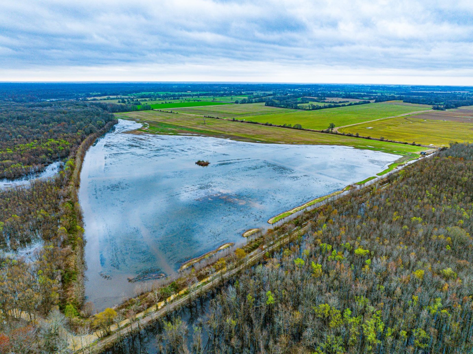
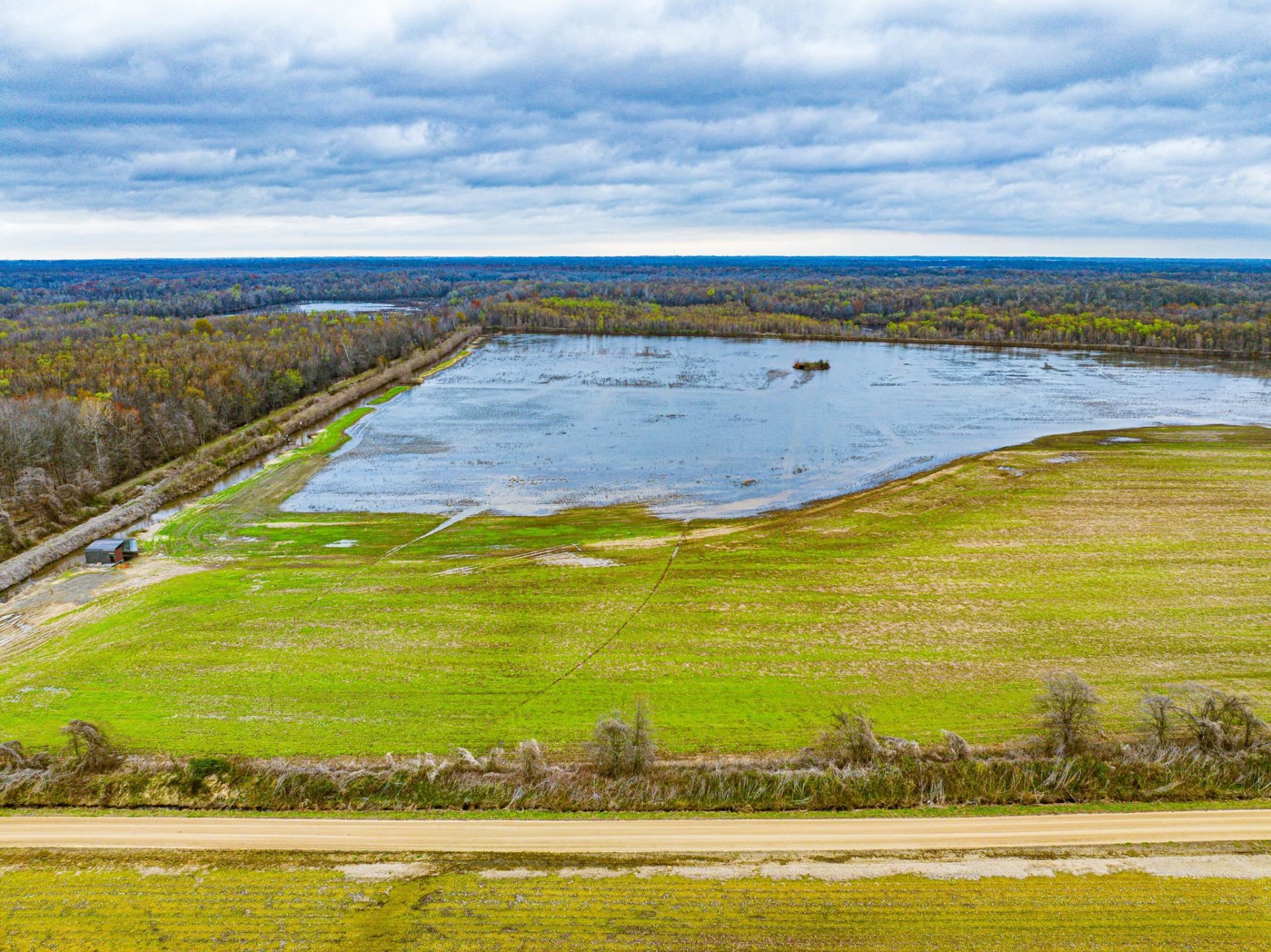
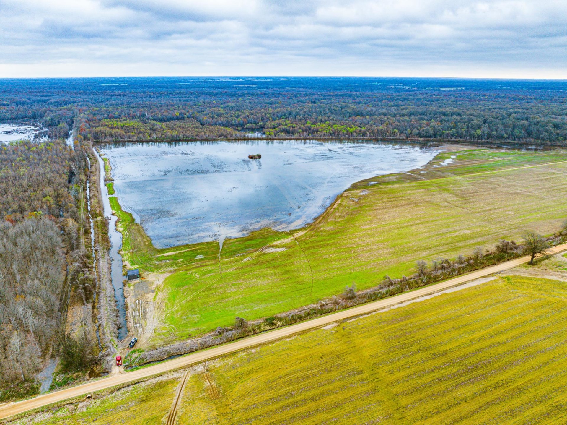
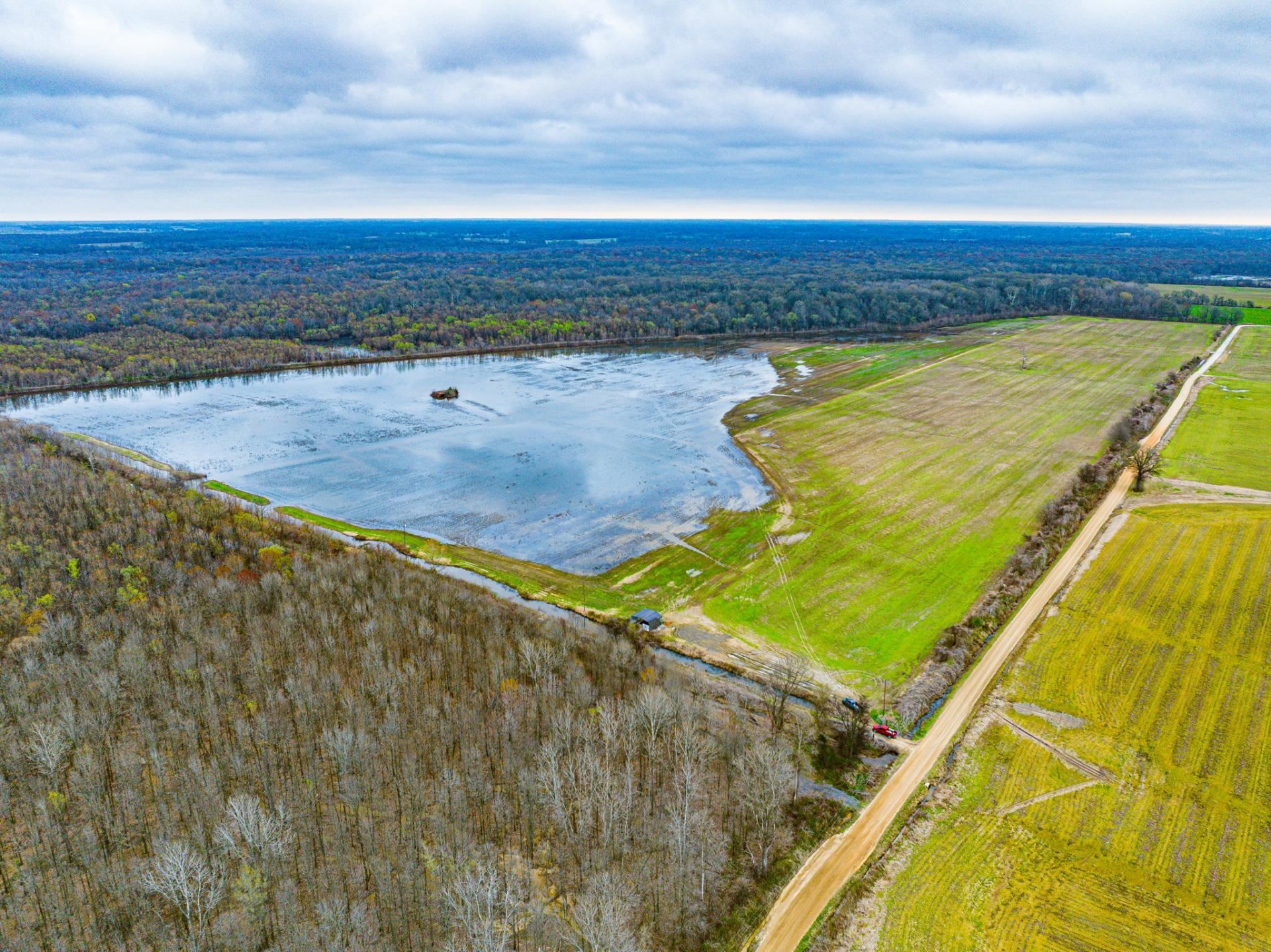
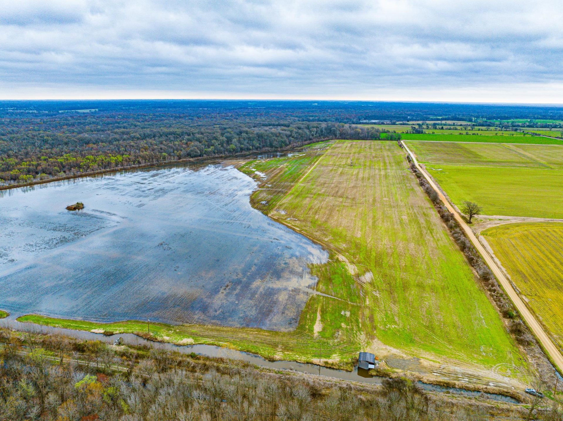
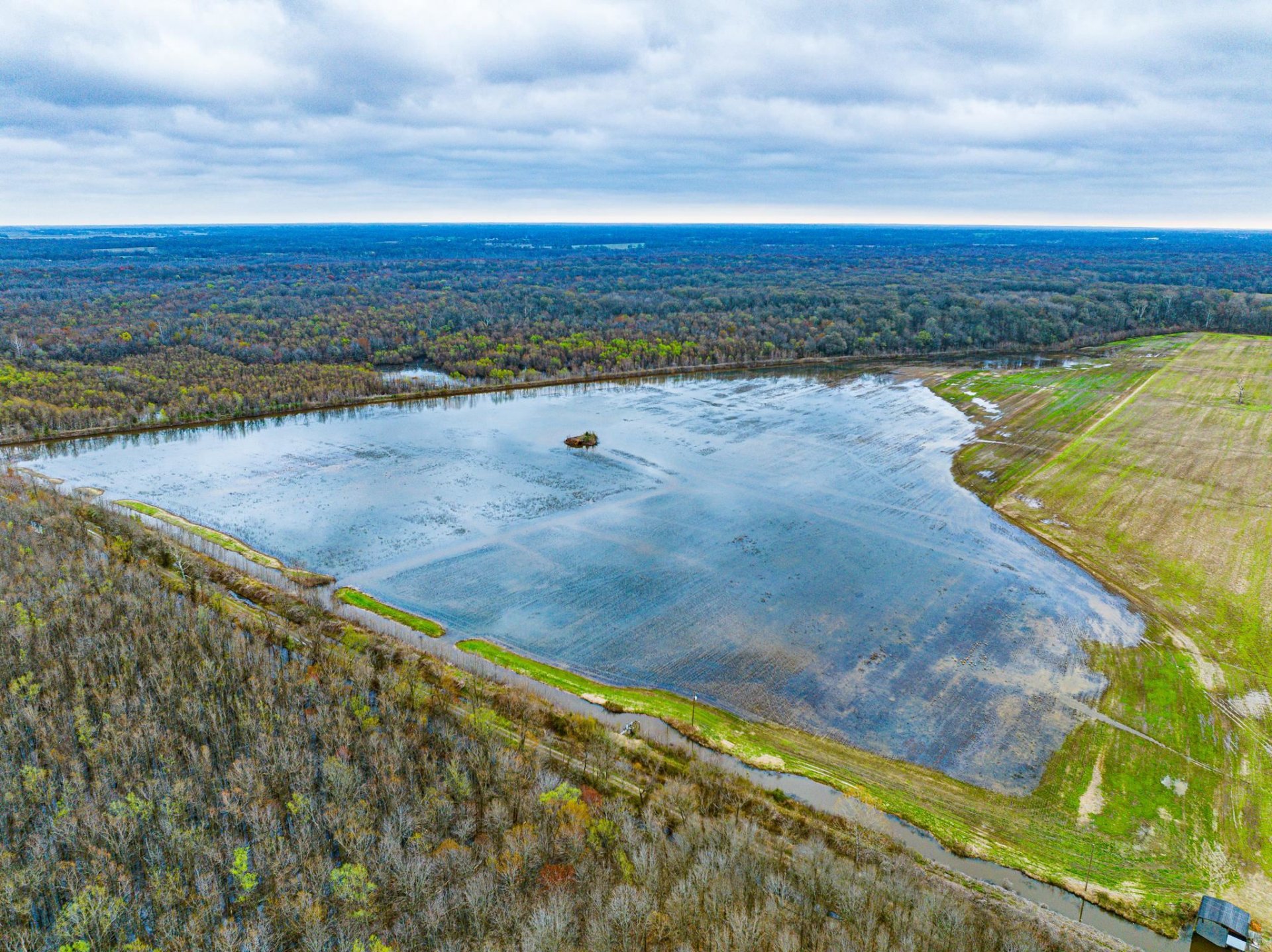
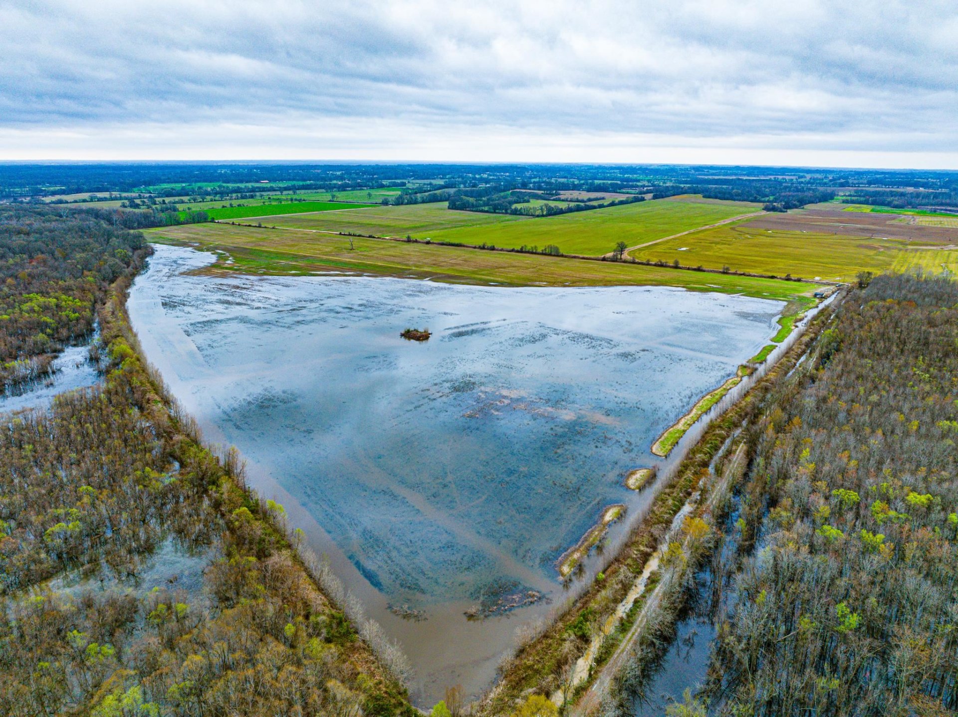
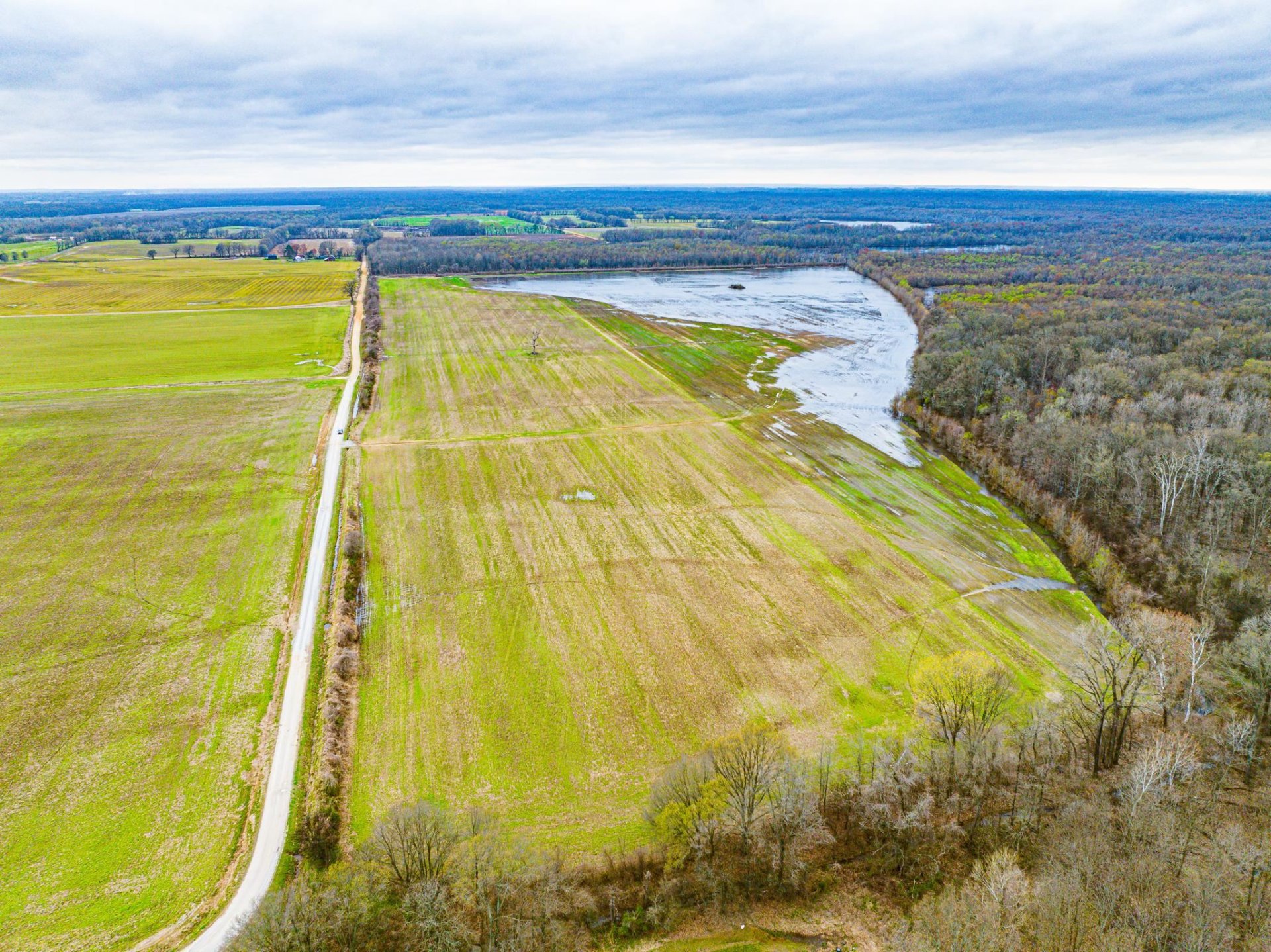
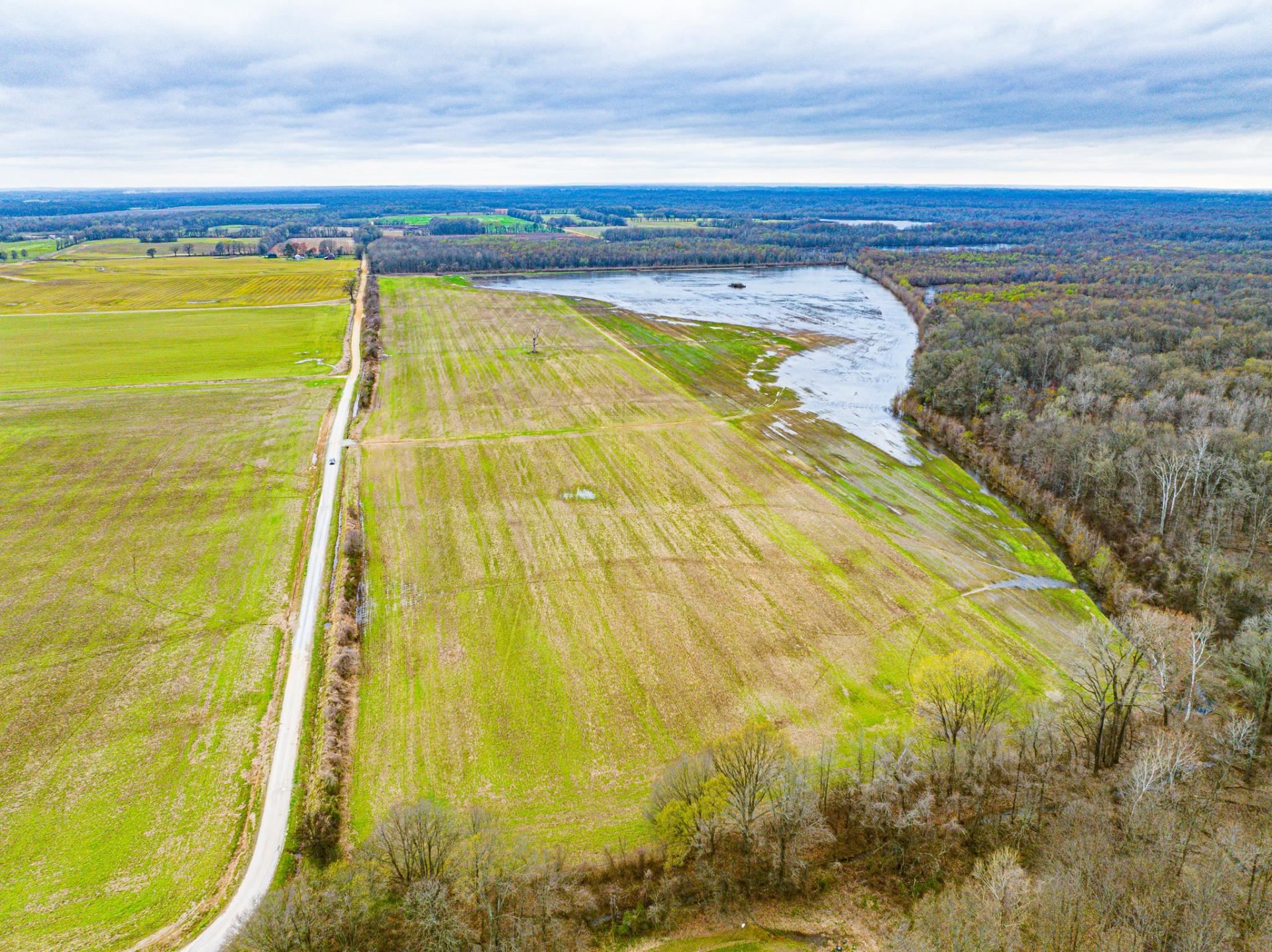
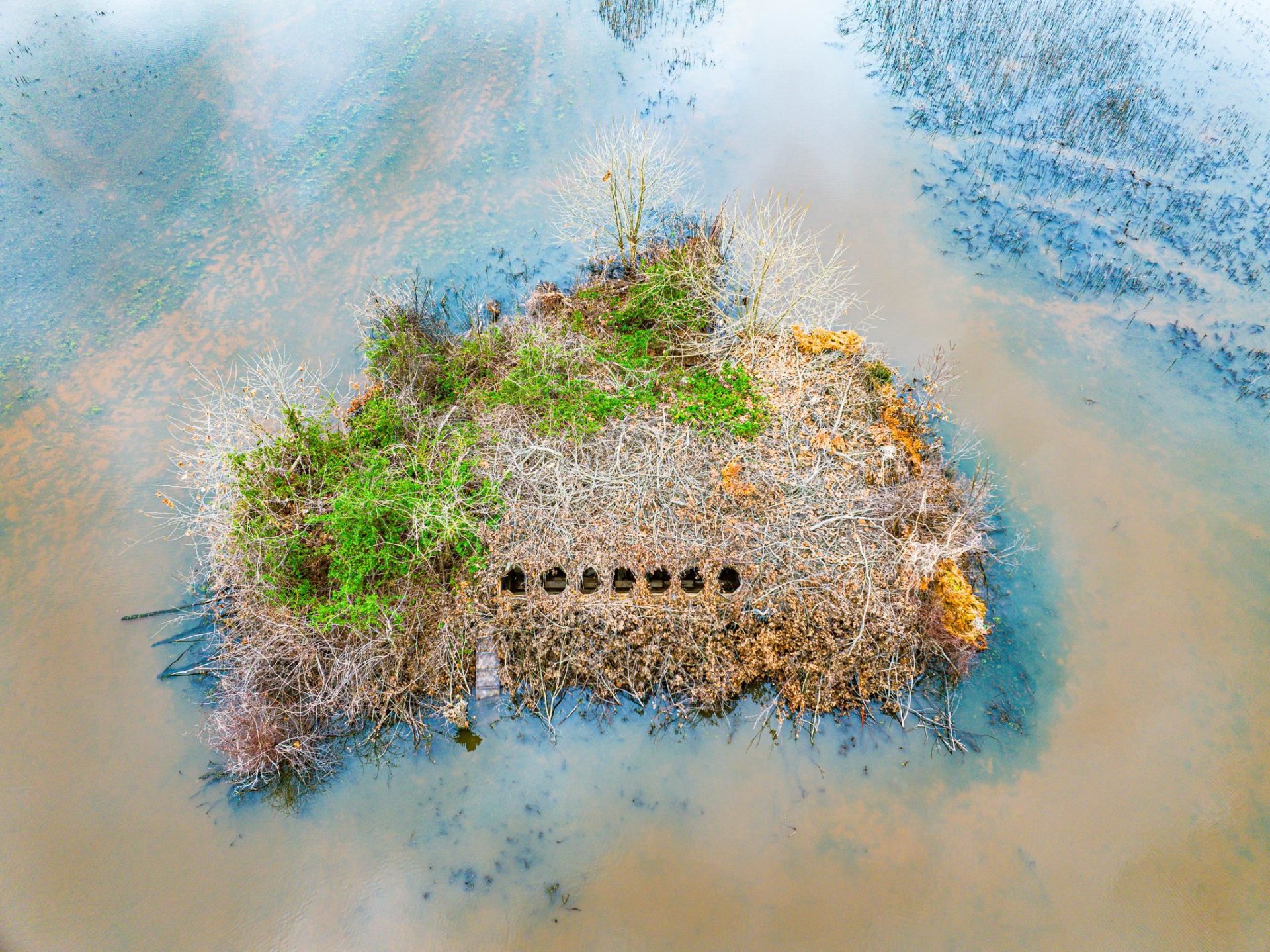
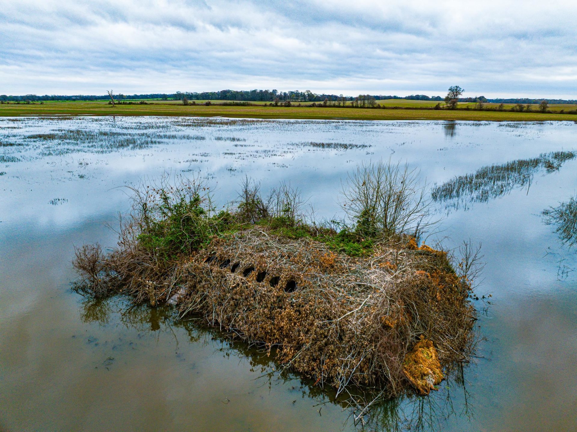
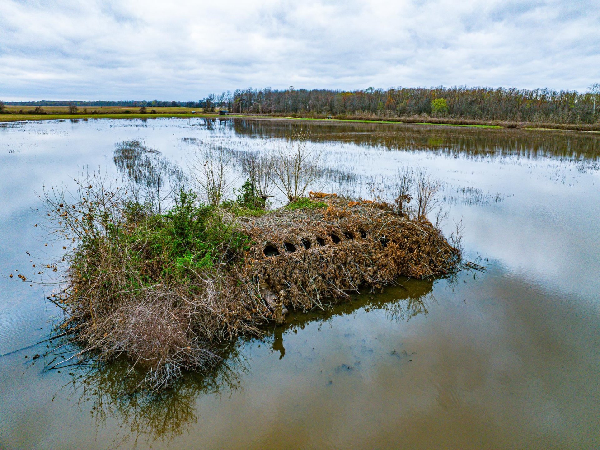
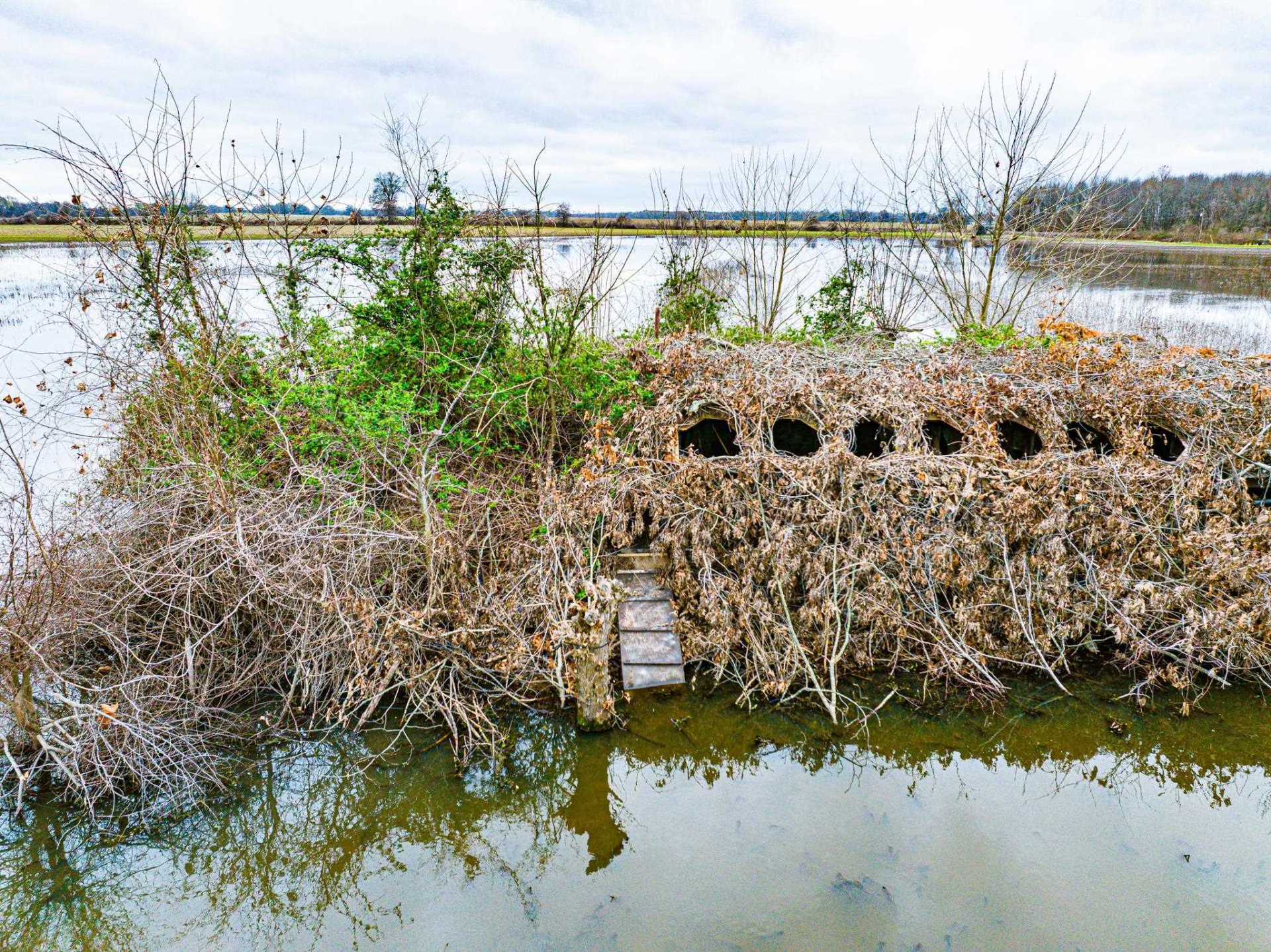
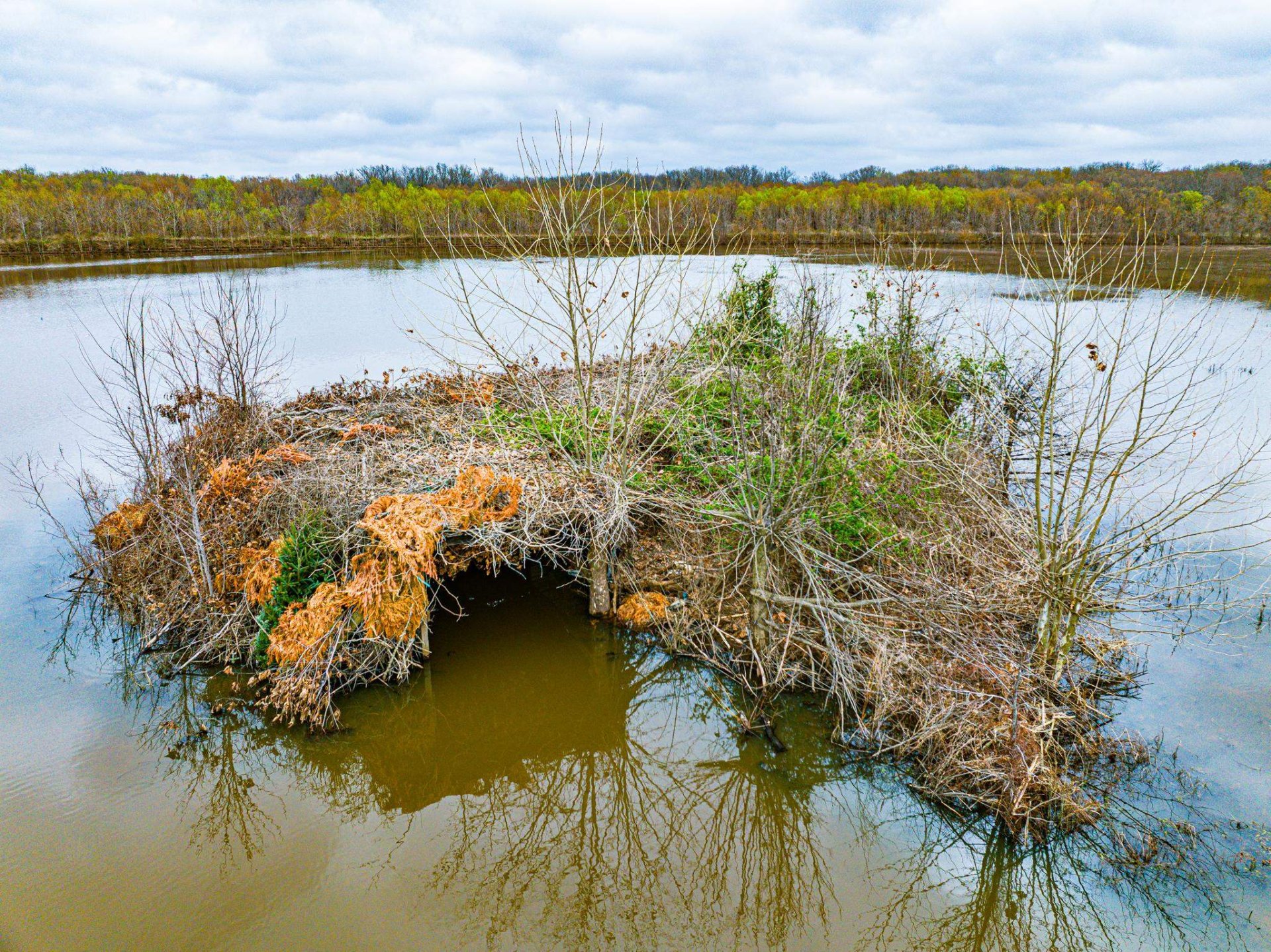
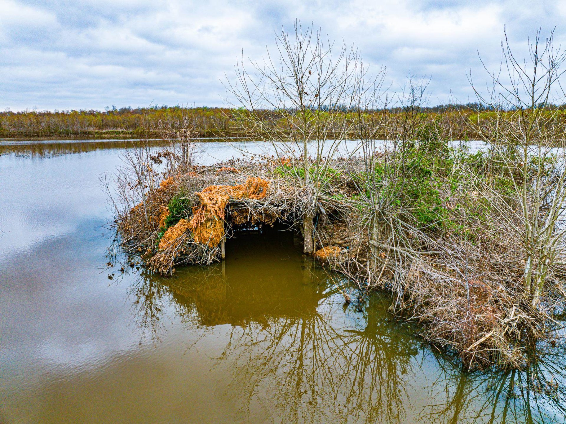
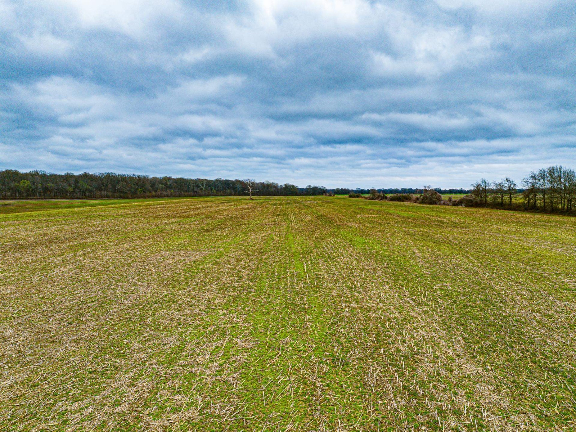
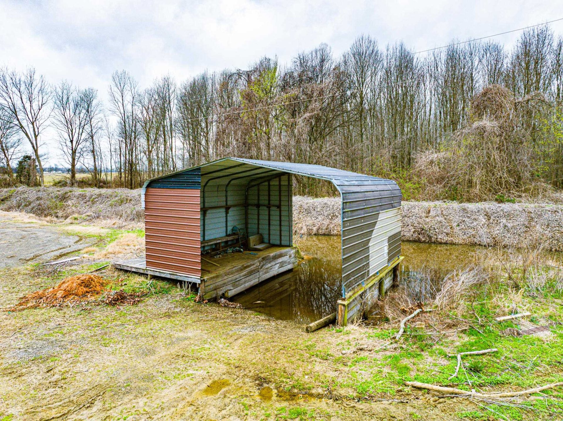
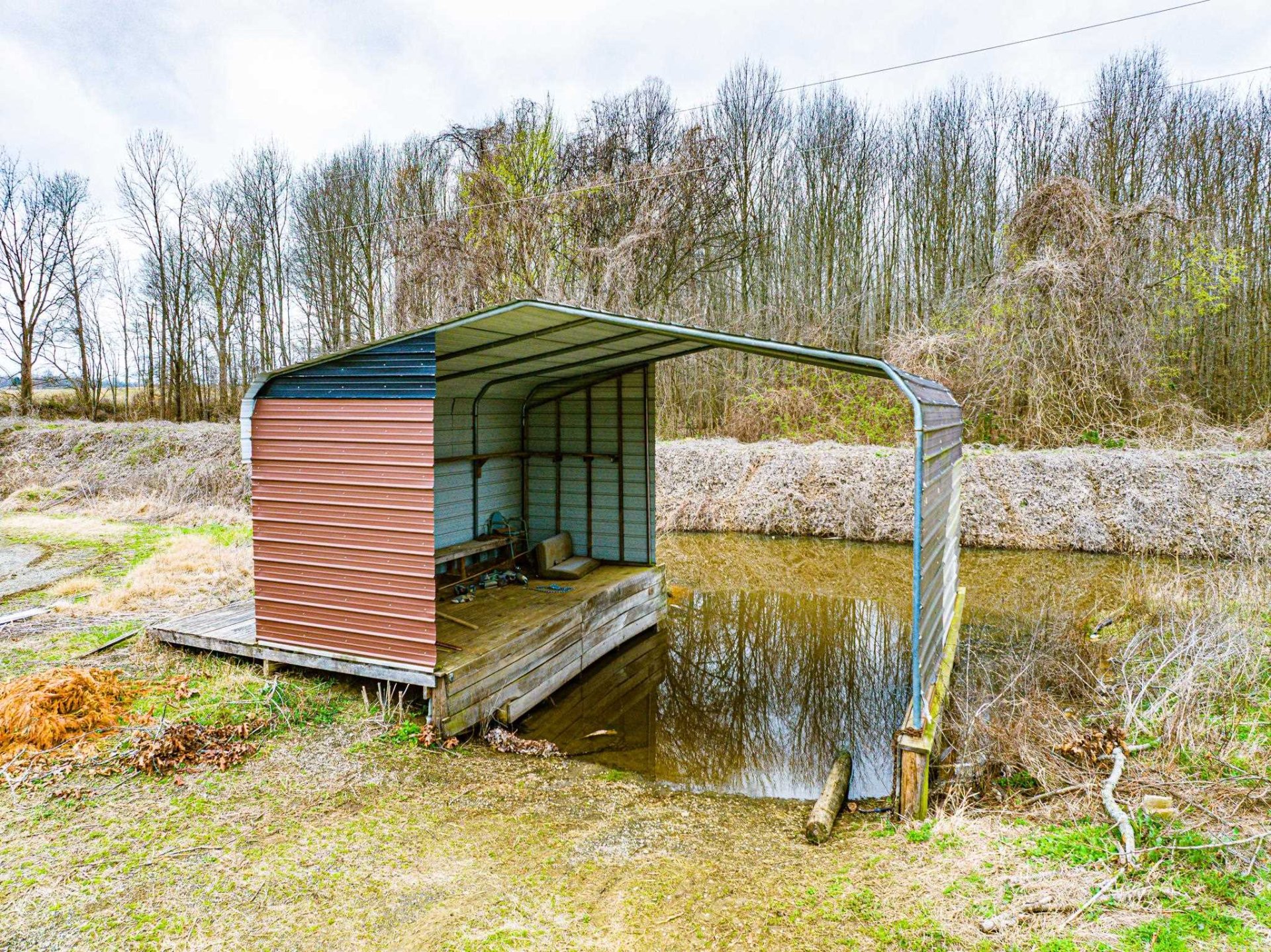
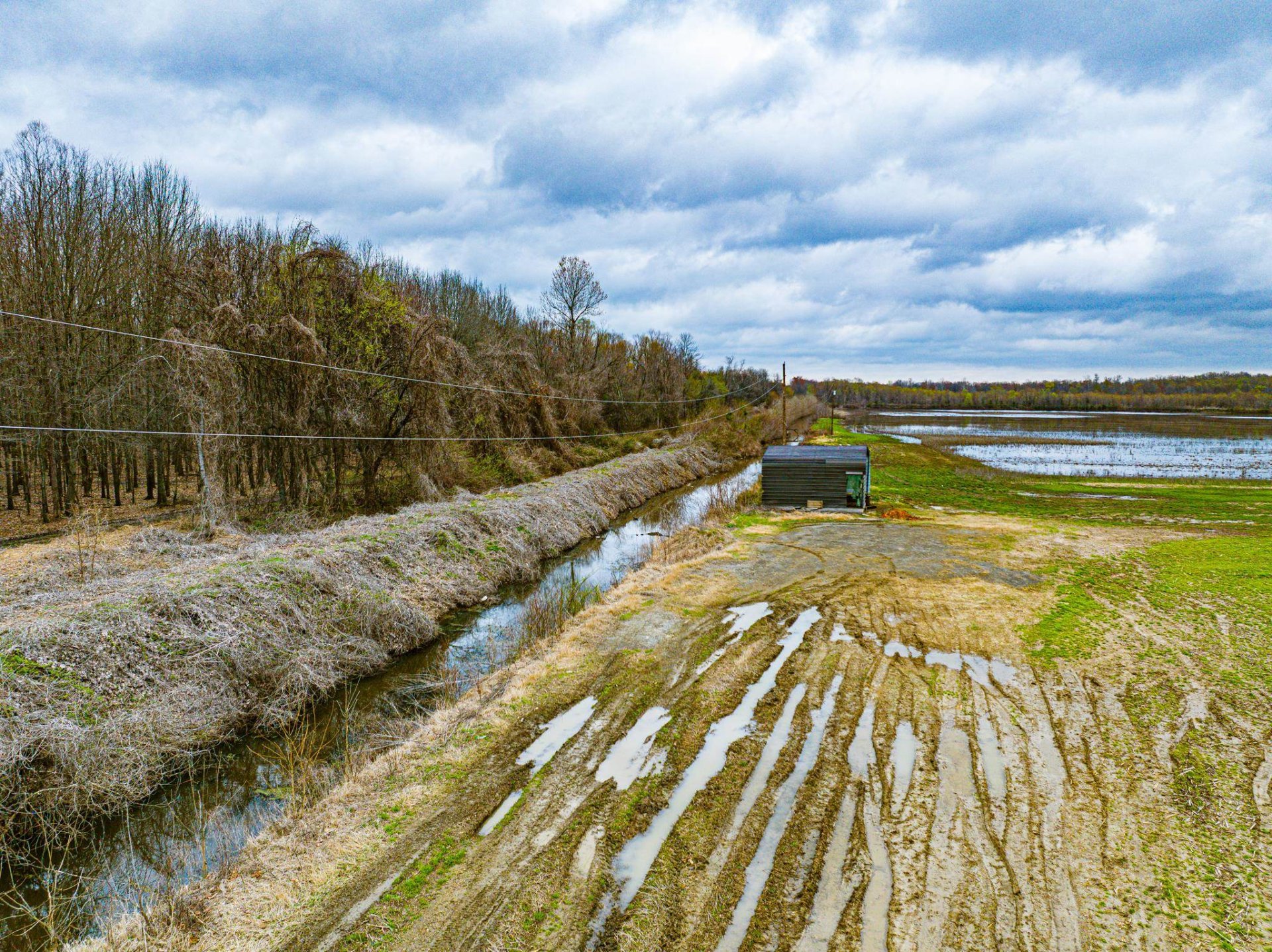
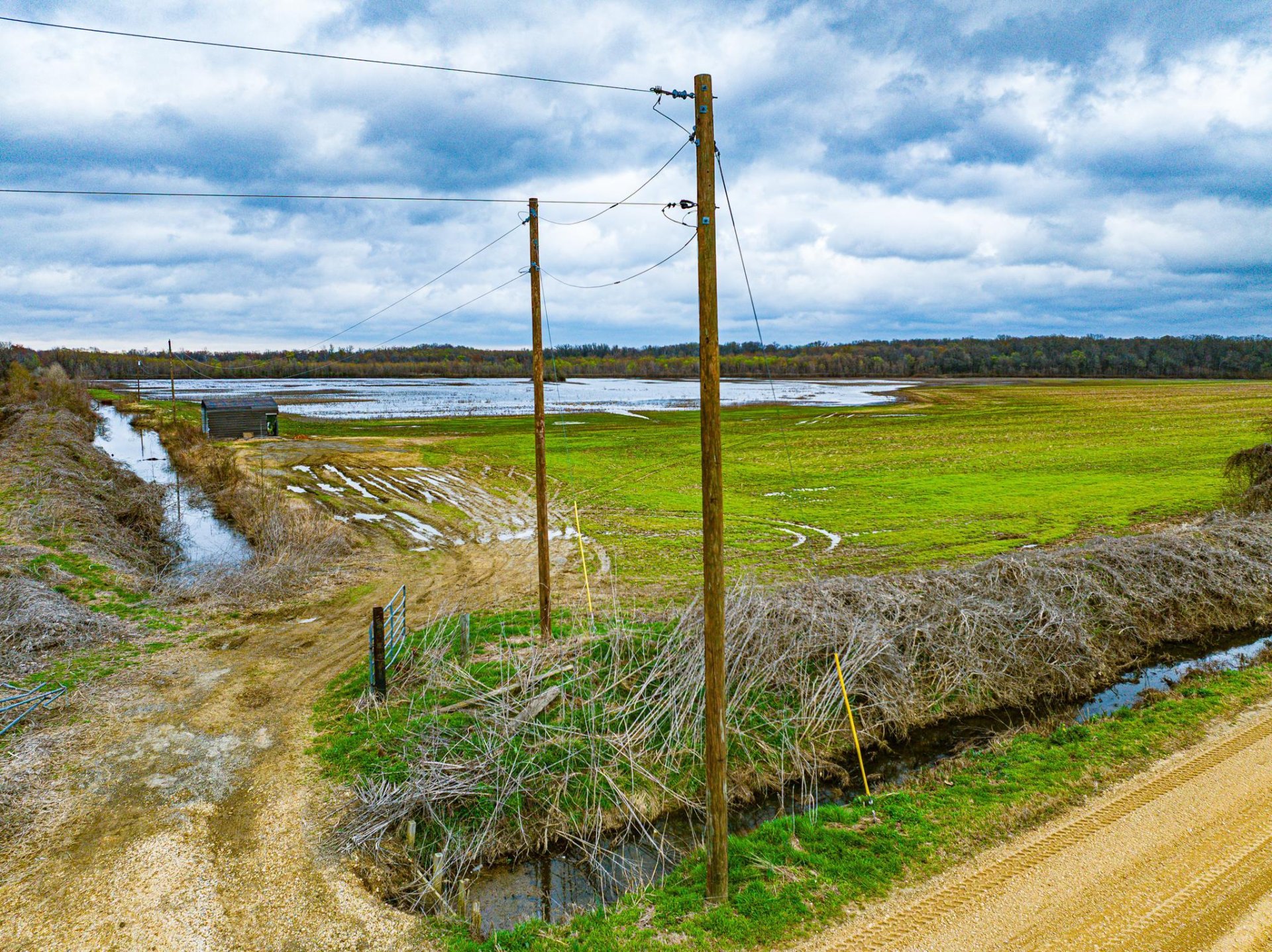
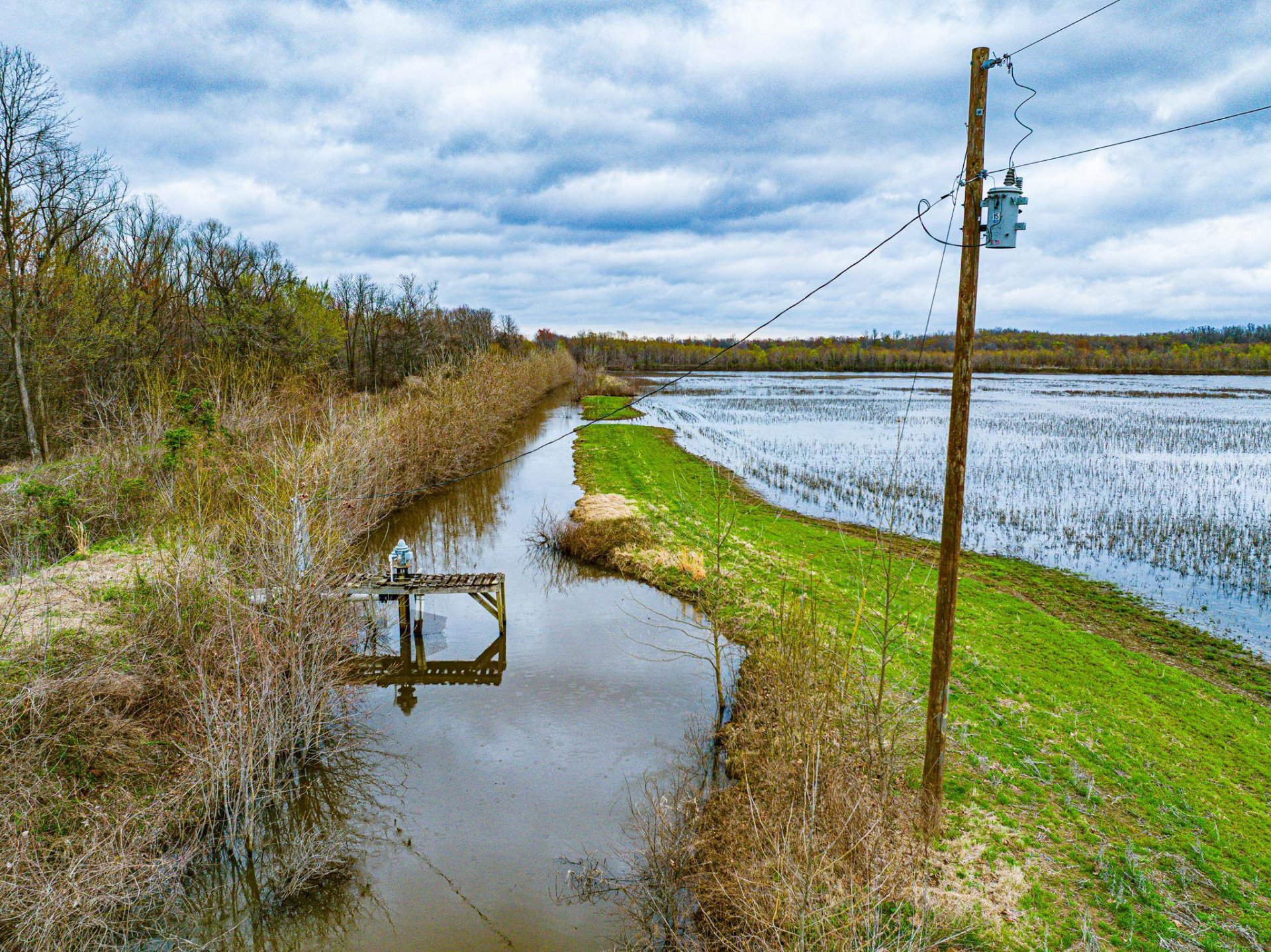
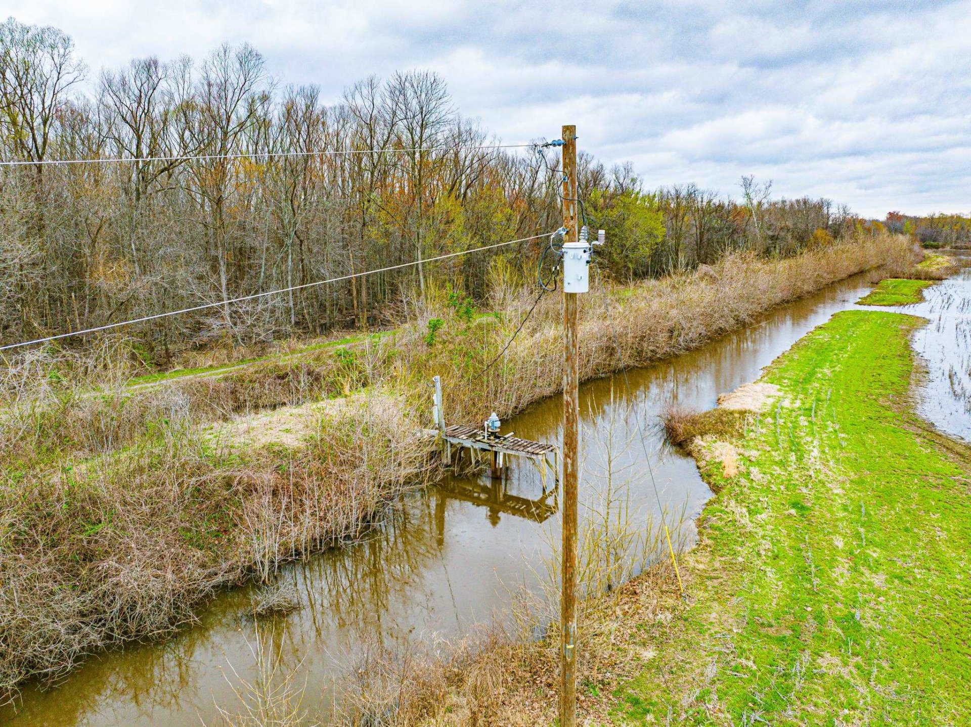
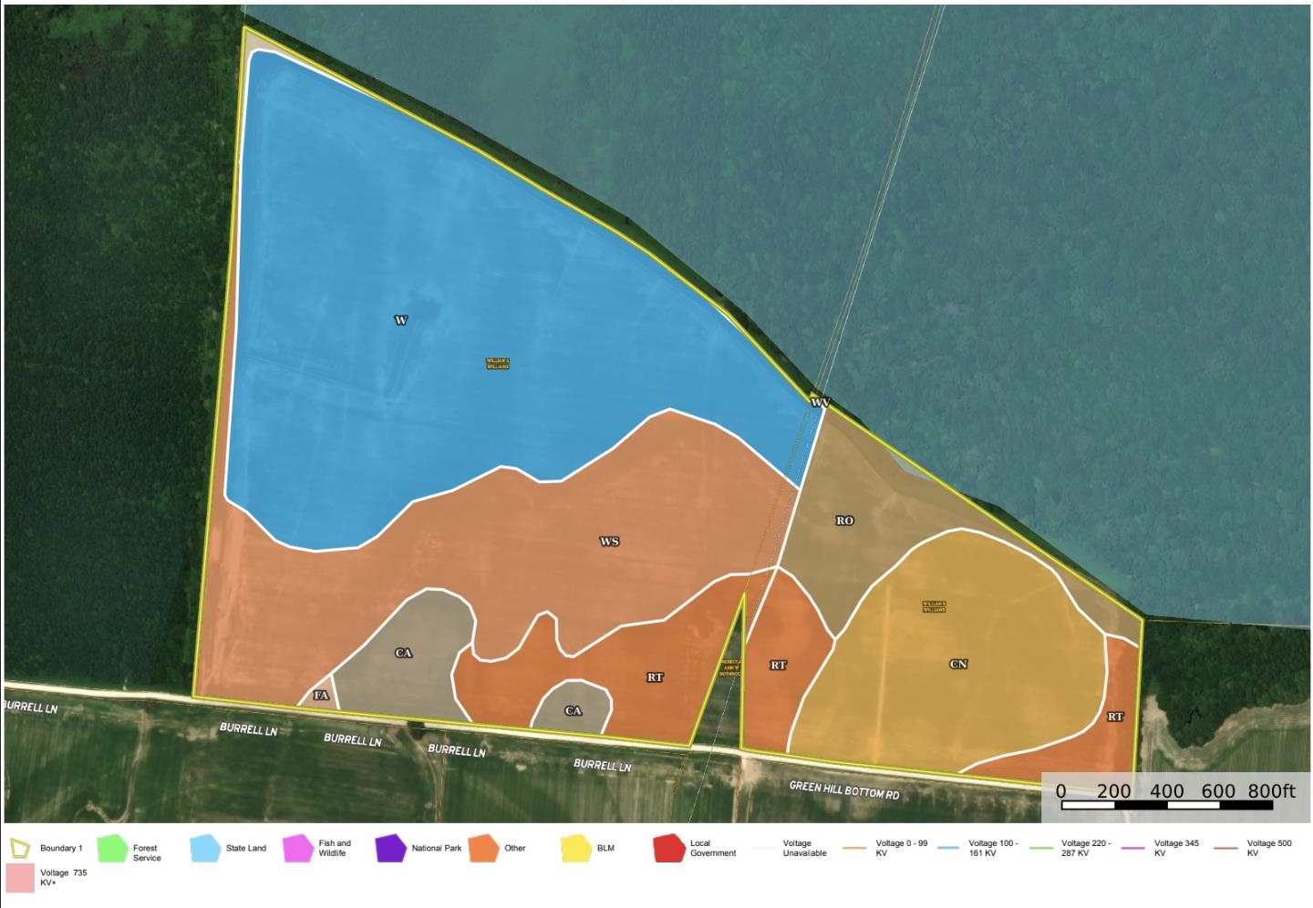
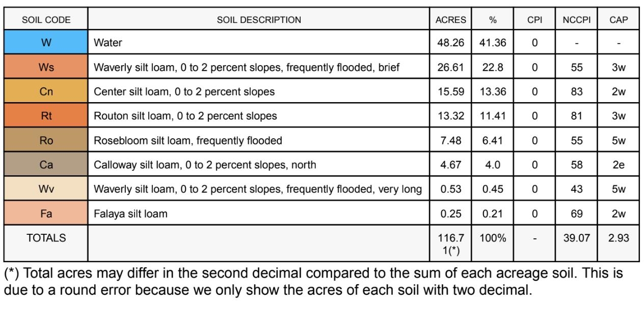
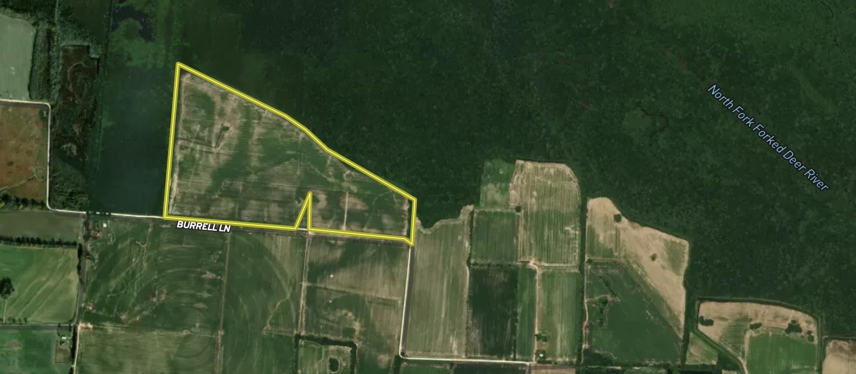
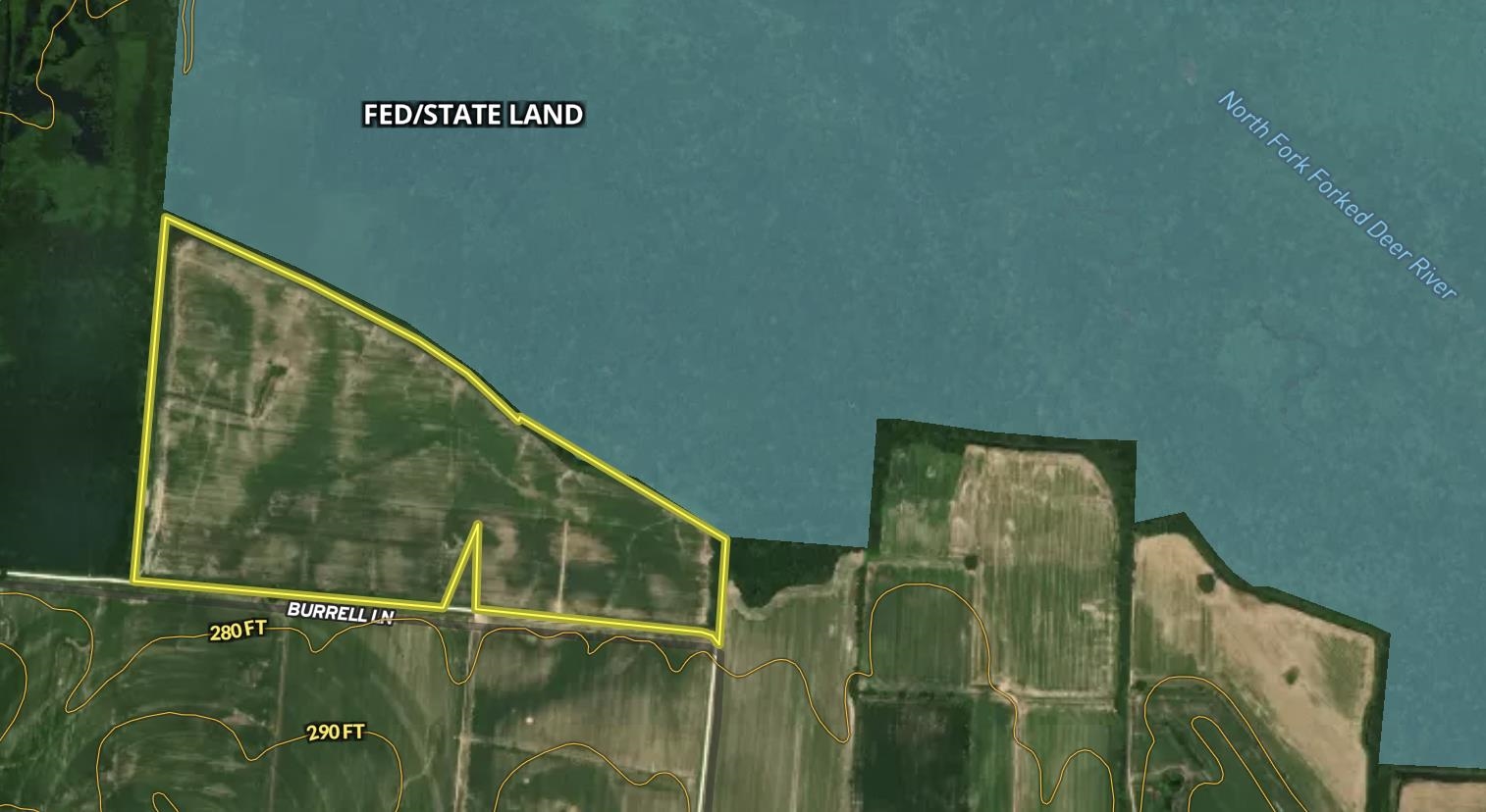
This 116.6± acre tract in Dyer County, TN offers a rare turnkey waterfowl impoundment combined with productive row crop ground, directly bordering the southern boundary of Tigrett WMA. The property includes a floodable field capable of holding water on approximately 62± acres, supported by an established levee system and on-site water pump for controlled flooding. A permanent pit blind with clean shooting openings, brushed-in boat hide, and dog ramp is already in place. A covered dock and dredged canal provide direct boat access to the blind. Additional acreage beyond the current flooded footprint allows for expanded blind locations or dry field setups. The farm features quality silt loam soils with strong productivity. Located near the Middle Fork of the Forked Deer River, this property offers an ideal blend of waterfowl hunting and income-producing farmland.
Features
Exterior & Lot
| Lot Dimensions | 116.6 acres |
Neighborhood
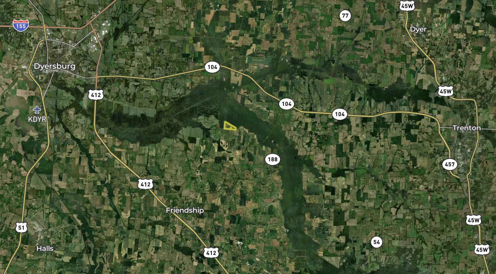
| Directions | From Dyersburg: Take TN-104 E, US-412 E, Old Hwy 20 and Stokes Rd to N Green Hill Bottom Rd 18 min (13.7 mi), Continue on N Green Hill Bottom Rd. Take Jernigan Rd to Burrell Ln 5 min (2.5 mi) |
Utilities
| Utilities | Electricity |
Financial
| Annual County Tax | $451 |
Contact Agent

Location
1 / 27
BURRELL